Sailing to Scotland
Tim Owen
8th Aug 2023
Sepsis is a 1986 Moody 37, one of only two made with a lifting keel that takes her draft from 2.3 m to 1.4 m with the aid of a hydraulic ram and an electric or manual pump. She has been in one family since new and spent most of her life either in the south of France or in Greece. When the original owner died she festered in Greece for a number of years until she was sailed back to the UK, or rather motored at slow speed with a furred up engine as there was no wind. She aquired a new Sole Mini44 engine in Gibraltar, together with an autopilot and new chart plotter and was then based at North Fambridge while further work was done. Covid shut that down for a couple of years and I got involved as we all recovered from that trauma. The two generations of the family now looking after her had no great love of East coast sailing and liked the idea of basing her on the West Coast of Scotland where they had had their introduction to sailing in a previous family boat – a Rival 32. A berth was booked in to an Oban Marina for 2023 and the race was on to get her ready to take up. We originally planned to take her up in spring 2023, but she went into Fox’s Marina in Ipswich in October for 3 weeks work dropping the keel and rudder to replace bearings and taking the mast down so we could work on the in-mast reefing. The reefing was an Easy Reef addition to the Selden mast, and the inner spar had somehow got damaged. Easy Reef is no longer in existence but we managed to source some spare lengths from the mizzen mast of a larger yacht that had removed its system. Due to staffing issues at Fox’s the three weeks turned into 5 months and we finally got on with the work at North Fambridge in April 2023 There followed a couple of months while we worked through a number of routine and non routine problems – One unexpected one being the unpredicted demise of the 4.5Kg calor cylinder (since rescinded, but for how long?) that led me to build a separate gas locker on the stern to hold anything up to two 10Kg Gaslite plastic cylinders of propane – ideal for a boat as they are light and can be dragged and banged around without marking the deck. We had trouble starting the engine – that took a bit of detective work – it was only when Penny was down watching the voltmeter as I tried to start the engine that she noticed the chart plotter go blank as the key was turned – since they are on separate circuits that pointed to an earth fault, and indeed on checking, the battery negative connections were very corroded and wired a little strangely – also why the windlass didn’t always run! Another job that was in my view essential for Scotland was to fit a diesel heater, so I fitted a Webasco AirTop Evo 40. One advantage of a do-it yourself fit is that you can spend a long time planning and exploring routes for the ducts and try things using short lengths of pipe without it adding to the bill – we managed to get outlets where we wanted them with minimal compromise . One of my other activities is mechanical design and 3D printing so I was able to print custom duct fittings in carbon fibre reinforced nylon where there wasn’t a suitable fitting available – in fact I printed a number of different things for the boat including a set of mug holders for the binnacle so there was always a safe place to hold everyone’s drinks under way.
By mid July we thought we were about ready to set off, only unfortunately ran over the mooring and had to have a quick lift-out to untangle the prop. Fortunately no damage, and a chance to clean off a small forest of barnacles that had grown in the 3 months or so she had been on a mooring. I had ‘done’ the East Coast trip to Inverness some 40 years ago in the previous family boat, and knew it was a bit of a slog, so I was a bit surprised when my wife Penny thought it would be a good thing to do in her highly constrained 2 week summer break from her job I recruited two of my sons, Rory and Tom. All of us are quite experienced small boat sailors, Rory has owned his own sailing boat and Penny and I have chartered on the West coast of Scotland for many years and we have both worked on research ships in the North Sea at some point, so can’t complain that we didn’t know what to expect!
I had spent a lot of time over the winter thinking about the passage North – Visit MyHarbour.com has lots on harbours etc. but until the publication of ‘Cook’s Country’ by Henry Irving (Imray) in the spring there wasn’t a pilot book for the northern section of the English East Coast . Passage planning for a trip like that from the River Crouch to Inverness has to be very flexible, especially as it involves the North Sea, which can be an unforgiving place – with almost nowhere to seek shelter in a hard blow from the East. I did contemplate doing the trip to Oban westabout, but it is substantially longer and the owners wanted to enjoy the Caledonian canal. When I last did the trip we did everything on paper charts and Dead Reckoning and the Admiralty pilot, plus I think one noon sun sight, but in those days things were much simpler – in particular there were no wind farms getting in the way, and no VTS with traffic highways in and out of the big ports that get agitated if you do the wrong thing, and anyway we didn’t have a VHF radio. The main framework of the passage plan has to be a list of harbours you can get into at any state of the tide, with a secondary list of those with tidal limits, and a tertiary list of anchorages with their limits on wind direction etc. Since we could put up our keel and get into places with only 1.5 m, life was somewhat simplified as most of the published information seems to take this as the ‘standard’ draft. You also need to tabulate H W tide times for all these places, and also rough periods when tidal flow will be in your favour or against, although this I left to be planned as we progressed. Navigation has changed markedly since I taught the RYA Yachtmaster course, although judging from comments I hear, I’m not sure the RYA has yet totally caught up with the gradual disappearance of paper charts! I did have paper charts to cover the area of interest – 3 Imray charts, plus some Admiralty charts that cost a fortune and had most of the detail removed from the areas I wanted it! But in truth I didn’t use them, except when running a pair of dividers to look at possible legs. My preferred charting is the Boating/Navionics App, now from Garmin, that I had running on two tablets – one mounted on the binnacle when sailing, one portable, and on two phones. When the tablets and my phone are on the internet via wifi or a hotspot they share routes etc. Sepiola has an AIS transmitter and receiver, and I have a separate AIS receiver on the stern locker that talks to my Navionics apps via wifi, although the range is poor due to lack of aerial height. The tablets are great – the one on the binnacle is not very easy to see in bright light, and in heavy rain when the screen is covered in droplets the touch screen doesn’t work until you wipe it clear, but its useable at all times, or you can duck under the sprayhood and look at the other tablet. An invaluable feature of the app is that you can click on the tide gauges or tidal arrows on the screen and display the tide height and stream now or at any time in the future.We had a Raymarine plotter running at the chart table with a pretty chunky version of Navionics charts that was really only useful as a way to see the AIS position of ships at sensible ranges – but using it meant going below, which for most of the trip was uncomfortable if not actually sick making or dangerous, and usually got water over the logbook and any charts that were out. In the event Rory often saw ships AIS on the Marine Radar App on his phone, which was useful as they are updated every minute when the ship is in range of a shore station and moving and we have phone coverage (most of the time). The Marine Radar app doesn’t appear to update the fix time of vessels at rest.
Our overall plan was to make a couple of short legs, from the Crouch to the Orwell (Woolverstone)
and from there to Lowestoft. From there its a long leg – if the weather was kind we planned to head for Scarborough with the option to anchor in the mouth of the Humber. From there you get a number of part day legs between all-tide ports until you get to the leg across the the Firth of Forth, which is a bit long for a single day, then another longish leg down the Moray Firth to Inverness, preferrably timing your arrival at the narrows at Chanonry Point for the rising tide, and to go through the bridge in Inverness when the tide isn’t against you, or for that matter, strongly with you. At the end of each leg I put in the detailed route for the next day, and checked over the list of harbours and anchorages and tides etc, plus committing the entry directions for the destination port to memory! In the back of my mind in planning was the crew limitation – I knew Penny and Tom had to be back with a pretty inflexible deadline of two weeks, although I figured that Rory and I could handle things if we had to, or we could call in reinforcements. In the run up to departure it became clear that we were in for a period of relatively unsettled weather as the June high pressure system had moved East and South and it was likely that at some point we might get bad weather – in any event it was likely to be changeable, meaning that detailed planning was not really possible in advance.
We loaded the boat in Fambridge Yacht Station – while loading Rory gashed his finger rather badly trying to save a runaway trolley so after an exploration of first aid kits he was patched up and decided a visit to A & E wasn’t necessary. The Yacht Station has tide limits so we motored down river and anchored at the junction with the Roach overnight to leave at 5 a.m. to get enough water to get over the Swin Spitway and take the tide most of the way to the Felixstowe. The 5 a.m. start works well as it corresponds to first light, giving you maximum daylight so we tended to keep it up for the whole trip. We were unsure about the amount of chain on the anchor, and about its marking when we anchored at the Roach so at Woolverstone Marina we flaked the chain on the pontoon and discovered that there were only 33 meters – OK for the Med where it had been, but not really adequate for the tidal UK, especially N.W. Scotland – we couldn’t source a suitable new chain en route so we added 18m of rope as a rode which just fitted in the anchor locker . We left at 5 the next morning for Lowestoft and had a pleasant sail, ending in a bit of motoring as the wind backed. Penny hadn’t been able to join Sepiola at the start as her father was ill, so came up to Lowestoft the next day and we left at 1500 hrs when she arrived. Rory took the opportunity to ring 101 and go to the small injuries unit to get his finger properly dressed.
Lowestoft to the Humber/Grimsby is quite a slog and the wind was likely to be from the NW so the anchorage just inside Spurn Point was not likely to be comfortable, Reeds, however, suggested one off Tetney on the SW side of the estuary that sounded fine, We did originally think that we might make it to Scarborough and were prepared for both options. We started from Lowestoft with a fair wind on the quarter and as we got round the top of Norfolk the wind increased until we were on a broad reach with full sail in 20 to 24 knots making 8 knots by GPS (our log wasn’t working) The seas didn’t have much fetch so we sailed without too much motion. The wind gradually increased, gusting 25-28 knots so we reefed both sails. I’d been hand steering but as the wind increased and the seas built up as we diverged from the coast it became more and more difficult to steer an accurate course, and more and more tiring As it got dark we reefed again and started the engine to give us some more control and power the auto-pilot as the seas built up, The auto pilot steers a much better and steadier course than I can, and if over pressed in a strong gust lets the boat round up a little to relieve pressure on the sails – it felt very secure. I’d set our route to converge on the small boat track along the edge of the VTS track for outbound ships from the Humber South but didn’t notice that our course was a couple of degrees off and we drifted into the traffic lane and were called up by a ship passing down the lane to alter course to Port, which initially puzzled me til I realised what had happened. Without an AIS transmitter it would have been more difficult to identify the call from the ship. By the time we’d been bumped around during the night it was clear that it wasn’t sensible to go on to Scarborough so we made the Humber estuary around 7:30 a.m. and called up VTS for permission to enter and proceed to Tetney and were warned to keep 500 m clear of the Monobuoy – the oil transfer buoy in the entrance to the Humber. We followed the 3m contour round and anchored near the WWII Haile Sands Fort in calm water.
We left the Tetney anchorage at 5 am the next morning, calling VTS on ch 14 for permission to cross the traffic lanes between buoys Bravo and Charlie and were asked to report at Buoy 2 for clearance to cross, and told to keep clear of the Monobuoy (again). Since we had an AIS transmitter, VTS could track our position. At buoy 2 there were no ship movements in the area so we called and were cleared to cross. We motored all the way to Scarborough, arriving at the rather crowded harbour and were directed to raft up against a couple of small fishing boats against the quay – access on and off the boat not easy! The harbour is heavily used by pleasure craft for holiday makers and is hectic and noisy during the daytime but fortunately very peaceful at night. Another early start and a good sail took us Harlepool where we arrived within the 4 hour window either side of High Water that the lock operates. On the way into Harltlepool as we ran the engine I opened the side cover to check if the stern gland was leaking – it wasn’t, but my head torch illuminated a little jet of water coming out of the seam around the bottom of the stainless exhaust box – A quick sharpening of a matchstick made a temporary partial plug till we got in, although the jet was not enough to do much harm. Once in I cleaned up the bottom seam and identified a small hole – the rest of the seam looked OK and survived probing with a point. A quick call to the owners revealed that there was very old Milliput epoxy putty on board somewhere, but to be safe a crew member was dispatched to Toolstation to get some plastic metal. Rather stiff Milliput found, I did a trial to make sure it was going to set hard, but realised that it was very difficult to mix thoroughly, obviously vital, so spent longer cutting and mixing to ensure the epoxy and hardener were completely mixed before drying the area and cleaning it with acetone and pressing in a fillet around the area of the leak. We topped up fuel and water – Sepiola has a rather small water tank – around 140 litres, and a 130 litre fuel tank, with 40 litres in cans in the lazarette. By morning the Milliput was rock hard and the test lump I had stuck on the top of the exhaust box without cleaning the metal had stuck fast so I figured that the leak was pretty well sealed so we had another 5 a.m. start towards Blyth. We stopped outside the harbour to pump the bilges as the exhaust leak had clearly been running for some time.
A very brisk sail, getting up to 34 knots in the gusts took us to Blyth by 1700 hrs. where we motored in against a 24 knot headwind.
We were getting quite anxious about the weather forecasts which suggested the weather might get bad in the next 48 hours, particularly round the headland into the Moray Firth, and discussed stopping at Eyemouth or making directly for Peterhead, I decided that we would make a decision when we were near Eyemouth depending on how battered we felt. Visibility was very patchy and we were sailing just off my planned route when we were called up by a windfarm guard vessel as we were on course to skim the corner of a windfarm – one of the problems of the Navionics vector charts is that the detail shown varies with the level of zoom, and the way we had it displayed for the longer passages didn’t show the windfarm – Windfarms are not outlined in pecked lines once they are completed so don’t show up at low zooms – something I hadn’t really realised before, and a bit of a problem as the East coast is a forest of wind farms! In the event we had a pretty fair sail to Eyemouth and decided to keep on to Peterhead across the Firth of Forth and up the Aberdeenshire coast, mindful that there were no easy boltholes on the way. As we were off Stonehaven the wind got up – I was below in my bunk resting – it was a bit too bouncy to sleep – I wondered how we were doing, so looked at Navionics on my phone and was surprised to see that we were only making 1.8 knots. Fully dressed in waterproofs and lifejacketed in record time I ventured on deck to find that the wind had got up very quickly and headed us so Rory was just motoring slowly into the wind to see if it carried on and take stock. As it didn’t go down we put the engine up to cruising revs and motored on course for Peterhead, making about 3.5 to 4 knots into the wind for several hours before the wind finally dropped.
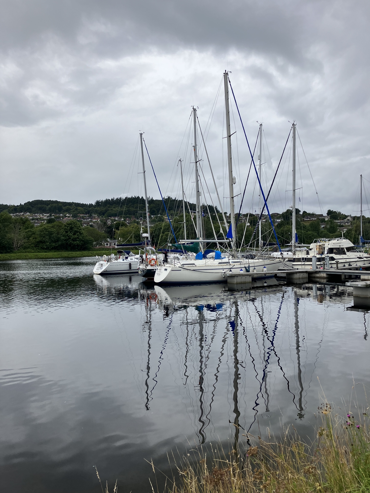
Peterhead was a very friendly port and marina. I called the marina, who said it would make life easier if I put the keel up, and the harbourmaster to get clearance to enter – he called us back when we were on the correct approach line – its a small marina but very helpful with good facilities although some way from shops etc. The Marina fuel pump was broken so the Marina harbourmaster took us in his van to refill our fuel cans and get essential supplies. Another 5 a.m. start saw us begin a very pleasant sail with a beam wind round into the Moray Firth and a wind on the quarter as we sailed towards the narrows at the start of the Inverness Firth. On the way we got an unexpected call from a guard vessel warning us we were heading for the 500m exclusion zone around a UXO (Unexploded Ordinance). Rather than take down the coordinates and plot them I asked if a 20 degree course alteration to port would take us clear, which was confirmed, and asked them to call us when we could resume our course – another advantage of an AIS transmitter! We called Inverness Marina by phone to book a place for the night and arrived at the narrows more or less on time to get to the bridge at slack water, which is advisable as the tide runs at up to 6 knots through the bridge, and makes turning into the river to get to the Inverness Marina quite tricky. We found the last space on the hammerhead in the Marina – rather a dreary place surrounded by very high quays, but good enough for overnight. The sea lock into the Caledonian canal only operates about 4 hours either side of high water, so we had to wait until 11:30 a.m. for a slot, but out lines were taken and we were quickly on our way to the swinging bridge and the next lock before the Seaport Marina. Tied up in Seaport, fuel topped up – job done!
What did we learn:-
Although the North Sea coast is not a particularly attractive cruising ground we enjoyed the challenge and never felt out of our comfort zone. Sepiola felt safe and not over pressed although she wasn’t particularly close winded and bounces around more than we are used to in slightly larger charter boats On the West coast of Scotland we usually consider the Inshore Forecasts to be on the pessimistic side, from our experience this time the forecasts were pretty optimistic – we had forecasts of 5 or less and sea state smooth or slight all the time – if only! I’d say that an AIS transmitter is pretty essential in the areas around the busy North Sea ports and windfarms, plus a good VHF at the wheel, and if you are trying to push on an autopilot is pretty much essential – we couldn’t balance the sails well in the waves we experienced and manual steering was exceedingly tiring and inaccurate, whereas the autopilot was happily turning the wheel through 100 degrees on each wave and keeping an arrow-straight course. We had changed the rigging to bring all the mainsail control lines back to the cockpit which was pretty much essential as it turned out, allowing us to reef when it would have been tricky working on deck. We averaged just over 6 knots over the whole journey and ran the engine for around 60% of the time at an average consumption of 3 litres per hour, mostly at 1750 or 1800 revs. We took 11 days from the Crouch to the Caledonian canal – if we had done the Crouch to Lowestoft in one leg, and the Humber to Hartlepool in another we could have done it in less, or if conditions had been more comfortable we could have done more night sailing. I’d highly recommend our second tablet – a reconditioned ruggedised 8 inch tablet supplied with raster charts and purchased through the VisitMyHarbour.com website – the original tablets cost around £500 so at £200 I recon its a decent buy and comes ready to go – just add a SIM card with some data if you want to use it that way. You will need a big back up USB battery pack to run it for more than a few hours.
Would we do it again? Well, perhaps ask in another 40 years!